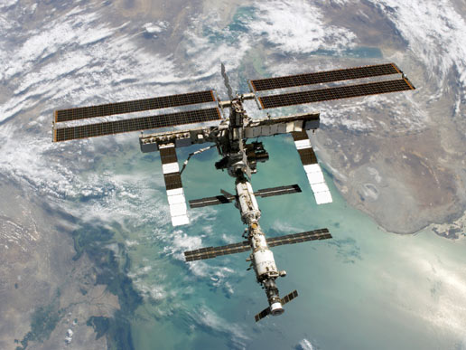
The International Space Station. Credit: NASA
Thursday, May 24, 2012
Wednesday, May 23, 2012
Tuesday, May 22, 2012
Monday, May 21, 2012
COMPOSITE PHOTO FROM THE ISF
FROM: NASA
This is a composite of a series of images photographed from a mounted camera on the Earth-orbiting International Space Station, from approximately 240 miles above Earth. Space station hardware in the foreground includes the Mini-Research Module (MRM1, center) and a Russian Progress vehicle docked to the Pirs Docking Compartment (right). Expedition 31 Flight Engineer Don Pettit said of the photographic techniques used to achieve the images: "My star trail images are made by taking a time exposure of about 10 to 15 minutes. However, with modern digital cameras, 30 seconds is about the longest exposure possible, due to electronic detector noise effectively snowing out the image. To achieve the longer exposures I do what many amateur astronomers do. I take multiple 30-second exposures, then 'stack' them using imaging software, thus producing the longer exposure." A total of 47 images photographed by the astronaut-monitored stationary camera were combined to create this composite. Image Credit: NASA
Sunday, May 20, 2012
Friday, May 18, 2012
JAXA'S GLOBAL CHANGE OBSERVATION MISSION
FROM: JAXA
Publisher :
Public Affairs Department
Japan Aerospace Exploration Agency (JAXA)
Marunouchi Kitaguchi Building,
1-6-5, Marunouchi, Chiyoda-ku, Tokyo 100-8260 Japan
TEL:+81-3-6266-6400
May 18, 2012 (JST)
Global Change Observation Mission 1st - Water "SHIZUKU" (GCOM-W1)
AMSR2 Antenna Deployment
Japan Aerospace Exploration Agency (JAXA) confirmed that the Global Change
Observation Mission 1st - Water "SHIZUKU" (GCOM-W1) successfully deployed the
antenna of the Advanced Microwave Scanning Radiometer 2 (AMSR2)* via image data
received at the Katsuura Tracking and Communication station.
The satellite is currently in good health.
* : Advanced Microwave Scanning Radiometer2 (AMSR2)
The AMSR2 measures electromagnetic waves called microwaves (six bandwidths
between 7 GHz and 89 GHz) emitted from nature, such as the ground and ocean
surface as well as objects in the atmosphere, to observe eight geophysical
parameters (integrated water vapor, integrated cloud liquid water,
precipitation, sea surface temperature, sea surface wind speed, sea ice
concentration, snow depth, soil moisture content).
Thursday, May 17, 2012
Tuesday, May 15, 2012
Monday, May 14, 2012
Sunday, May 13, 2012
Saturday, May 12, 2012
Subscribe to:
Comments (Atom)
